Home / Shipping Market Data / Ports500 WPI port locations
103 Countries & territories
7 World regions
Source: NGA World Port Index-derived 2019 geographic classification. This selection contains all 160 WPI Major ports and 340 sampled Minor ports; it is not a throughput-based global top-500 ranking . Location records do not verify berth suitability, vessel availability or port bunker supplier prices.
EXPLORE BY PORT
Maritime gateways to explore Real port photographs are shown only when their Wikimedia Commons licence and named location can be checked. Otherwise images are clearly identified as illustrative.
COMPLETE PORT DIRECTORY
Browse all 500 ports Every port links to its historical context, country profile, source notes and related maritime job search.
Showing 500 documented port locations.
Licensed maritime image; not verified as Aarhus · Wikimedia Commons · John Goldsmith · CC BY-SA 2.0 WPI 30260 · Minor reference port
Licensed maritime image; not verified as Abadan · Wikimedia Commons · Mick Garratt · CC BY-SA 2.0 WPI 48430 · Minor reference port
Port photo · Wikimedia Commons · John Allan · CC BY-SA 2.0 WPI 32220 · Minor reference port
Licensed maritime image; not verified as Abidjan · Wikimedia Commons · Robin Lucas · CC BY-SA 2.0 WPI 46000 · Major reference port
Licensed maritime image; not verified as Abu Dhabi · Wikimedia Commons · Ross · CC BY-SA 2.0 WPI 48278 · Minor reference port
Licensed maritime image; not verified as ACAPULCO · Wikimedia Commons · Unknown authorUnknown author · Public domain 🇲🇽 Mexico Latin America & Caribbean WPI 15760 · Minor reference port
Licensed maritime image; not verified as Adelaide · Wikimedia Commons · Peter Church · CC BY-SA 2.0 WPI 54220 · Minor reference port
Licensed maritime image; not verified as Aden · Wikimedia Commons · Bob Jones · CC BY-SA 2.0 WPI 48190 · Minor reference port
Licensed maritime image; not verified as Agadir · Wikimedia Commons · Ross · CC BY-SA 2.0 WPI 45802 · Major reference port
Licensed maritime image; not verified as Ain Sukhna · Wikimedia Commons · David Dixon · CC BY-SA 2.0 WPI 48055 · Major reference port
Licensed maritime image; not verified as Al Ain · Wikimedia Commons · Willie Duffin · CC BY-SA 2.0 WPI 48266 · Minor reference port
Licensed maritime image; not verified as AL BASRAH · Wikimedia Commons · Phinney S. Hunt · Public domain WPI 48400 · Minor reference port
Licensed maritime image; not verified as Albany · Wikimedia Commons · Ross · CC BY-SA 2.0 WPI 7720 · Minor reference port
Licensed maritime image; not verified as Alexandria · Wikimedia Commons · Hervé Cozanet · CC BY-SA 3.0 WPI 45165 · Major reference port
Licensed maritime image; not verified as Alexandroupolis · Wikimedia Commons · Malarky at English Wikipedia · Public domain WPI 42630 · Minor reference port
Licensed maritime image; not verified as Algiers · Wikimedia Commons · Chris Downer · CC BY-SA 2.0 WPI 45570 · Major reference port
Licensed maritime image; not verified as Alicante · Wikimedia Commons · Ross · CC BY-SA 2.0 WPI 38440 · Minor reference port
Licensed maritime image; not verified as Amsterdam · Wikimedia Commons · Rossographer · CC BY-SA 2.0 WPI 31060 · Major reference port
Licensed maritime image; not verified as Annaba · Wikimedia Commons · David Dixon · CC BY-SA 2.0 WPI 45490 · Minor reference port
Licensed maritime image; not verified as Antilla · Wikimedia Commons · Bob Jones · CC BY-SA 2.0 🇨🇺 Cuba Latin America & Caribbean WPI 10230 · Major reference port
Licensed maritime image; not verified as Antofagasta · Wikimedia Commons · Ross · CC BY-SA 2.0 🇨🇱 Chile Latin America & Caribbean WPI 14660 · Minor reference port
Licensed maritime image; not verified as Antwerp · Wikimedia Commons · hayley green · CC BY-SA 2.0 WPI 31250 · Major reference port
Licensed maritime image; not verified as Apra · Wikimedia Commons · Hervé Cozanet · CC BY-SA 3.0 WPI 56550 · Minor reference port
Licensed maritime image; not verified as ARGENTIA · Wikimedia Commons · Eric Jones · CC BY-SA 2.0 WPI 1710 · Minor reference port
Licensed maritime image; not verified as Arkhangelsk · Wikimedia Commons · Ross · CC BY-SA 2.0 WPI 62800 · Minor reference port
Licensed maritime image; not verified as Atherinolakkos · Wikimedia Commons · Frances McIntosh · CC BY-SA 4.0 WPI 43130 · Minor reference port
Licensed maritime image; not verified as Auckland · Wikimedia Commons · USN · Public domain WPI 55060 · Major reference port
Licensed maritime image; not verified as Aveiro · Wikimedia Commons · Andy Farrington · CC BY-SA 2.0 WPI 37970 · Minor reference port
Licensed maritime image; not verified as Axelsvik · Wikimedia Commons · Ross · CC BY-SA 2.0 WPI 27280 · Minor reference port
Licensed maritime image; not verified as BAHIA DE SAGUA DE TANAMO · Wikimedia Commons · Asahel Curtis · Public domain 🇨🇺 Cuba Latin America & Caribbean WPI 10270 · Major reference port
Licensed maritime image; not verified as Balboa · Wikimedia Commons · pam fray · CC BY-SA 2.0 🇵🇦 Panama Latin America & Caribbean WPI 15410 · Minor reference port
Licensed maritime image; not verified as Baltimore · Wikimedia Commons · Australian armed forces · Public domain WPI 8210 · Major reference port
Licensed maritime image; not verified as Bandar Abbas · Wikimedia Commons · Robin Stott · CC BY-SA 2.0 WPI 48520 · Minor reference port
Licensed maritime image; not verified as Bangkok · Wikimedia Commons · U.S. Navy · Public domain WPI 57450 · Major reference port
Licensed maritime image; not verified as Banias · Wikimedia Commons · David Dixon · CC BY-SA 2.0 WPI 45005 · Major reference port
Licensed maritime image; not verified as Barcelona · Wikimedia Commons · pam fray · CC BY-SA 2.0 WPI 38550 · Major reference port
Licensed maritime image; not verified as Bari · Wikimedia Commons · David Dixon · CC BY-SA 2.0 WPI 40530 · Minor reference port
Licensed maritime image; not verified as Barranquilla · Wikimedia Commons · pam fray · CC BY-SA 2.0 WPI 11930 · Minor reference port
Licensed maritime image; not verified as Barry · Wikimedia Commons · David Hawgood · CC BY-SA 2.0 WPI 34990 · Minor reference port
Licensed maritime image; not verified as Bashayer · Wikimedia Commons · Andy Farrington · CC BY-SA 2.0 WPI 47944 · Minor reference port
Licensed maritime image; not verified as Batangas City · Wikimedia Commons · David Hawgood · CC BY-SA 2.0 WPI 58320 · Minor reference port
Licensed maritime image; not verified as Bayonne · Wikimedia Commons · Albert Bridge · CC BY-SA 2.0 WPI 37230 · Minor reference port
Licensed maritime image; not verified as Bayonne · Wikimedia Commons · Albert Bridge · CC BY-SA 2.0 WPI 7790 · Minor reference port
Licensed maritime image; not verified as Beaumont · Wikimedia Commons · Albert Bridge · CC BY-SA 2.0 WPI 9140 · Minor reference port
Licensed maritime image; not verified as Beira · Wikimedia Commons · Albert Bridge · CC BY-SA 2.0 WPI 46890 · Minor reference port
Licensed maritime image; not verified as Beirut · Wikimedia Commons · Ross · CC BY-SA 2.0 WPI 45030 · Major reference port
Licensed maritime image; not verified as Belawan · Wikimedia Commons · Chris Allen · CC BY-SA 2.0 WPI 50730 · Minor reference port
Licensed maritime image; not verified as Belém · Wikimedia Commons · John Goldsmith · CC BY-SA 2.0 🇧🇷 Brazil Latin America & Caribbean WPI 12490 · Minor reference port
Port photo · Wikimedia Commons · HENRY CLARK · CC BY-SA 2.0 WPI 33770 · Major reference port
Licensed maritime image; not verified as Bell Bay · Wikimedia Commons · Mick Garratt · CC BY-SA 2.0 WPI 54940 · Minor reference port
Licensed maritime image; not verified as Benghazi · Wikimedia Commons · Robin Lucas · CC BY-SA 2.0 WPI 45280 · Minor reference port
Licensed maritime image; not verified as Bergen · Wikimedia Commons · Ross · CC BY-SA 2.0 WPI 23160 · Minor reference port
Licensed maritime image; not verified as Bilbao · Wikimedia Commons · Unknown authorUnknown author · Public domain WPI 37400 · Minor reference port
Licensed maritime image; not verified as Blyth · Wikimedia Commons · Peter Church · CC BY-SA 2.0 WPI 31820 · Minor reference port
Licensed maritime image; not verified as Boca Chica · Wikimedia Commons · Bob Jones · CC BY-SA 2.0 WPI 11035 · Minor reference port
Licensed maritime image; not verified as Bojonegara · Wikimedia Commons · Ross · CC BY-SA 2.0 WPI 50922 · Minor reference port
Licensed maritime image; not verified as Bonny · Wikimedia Commons · David Dixon · CC BY-SA 2.0 WPI 46205 · Minor reference port
Licensed maritime image; not verified as Bordeaux · Wikimedia Commons · Willie Duffin · CC BY-SA 2.0 WPI 37190 · Major reference port
Licensed maritime image; not verified as Boston · Wikimedia Commons · Phinney S. Hunt · Public domain WPI 7250 · Major reference port
Licensed maritime image; not verified as Boulogne-sur-Mer · Wikimedia Commons · Ross · CC BY-SA 2.0 WPI 35760 · Minor reference port
Licensed maritime image; not verified as Brake · Wikimedia Commons · Hervé Cozanet · CC BY-SA 3.0 WPI 30850 · Minor reference port
Licensed maritime image; not verified as Bremen · Wikimedia Commons · Malarky at English Wikipedia · Public domain WPI 30900 · Major reference port
Licensed maritime image; not verified as Bremerhaven · Wikimedia Commons · Chris Downer · CC BY-SA 2.0 WPI 30810 · Major reference port
Licensed maritime image; not verified as BREMERTON · Wikimedia Commons · Ross · CC BY-SA 2.0 WPI 17430 · Minor reference port
Licensed maritime image; not verified as Brest · Wikimedia Commons · Rossographer · CC BY-SA 2.0 WPI 36460 · Major reference port
Licensed maritime image; not verified as Bridgeport · Wikimedia Commons · David Dixon · CC BY-SA 2.0 WPI 7570 · Minor reference port
Licensed maritime image; not verified as Brindisi · Wikimedia Commons · Bob Jones · CC BY-SA 2.0 WPI 40500 · Major reference port
Licensed maritime image; not verified as Brisbane · Wikimedia Commons · Ross · CC BY-SA 2.0 WPI 53490 · Major reference port
Licensed maritime image; not verified as Bristol · Wikimedia Commons · hayley green · CC BY-SA 2.0 WPI 35070 · Minor reference port
Licensed maritime image; not verified as Brooklyn · Wikimedia Commons · Hervé Cozanet · CC BY-SA 3.0 WPI 7630 · Major reference port
Licensed maritime image; not verified as Buenos Aires · Wikimedia Commons · Eric Jones · CC BY-SA 2.0 WPI 13760 · Major reference port
Licensed maritime image; not verified as Buffalo · Wikimedia Commons · Ross · CC BY-SA 2.0 WPI 3430 · Major reference port
Licensed maritime image; not verified as BUFFINGTON · Wikimedia Commons · Frances McIntosh · CC BY-SA 4.0 WPI 4770 · Minor reference port
Licensed maritime image; not verified as Bullen Bay · Wikimedia Commons · USN · Public domain WPI 11820 · Minor reference port
Licensed maritime image; not verified as Busan · Wikimedia Commons · Andy Farrington · CC BY-SA 2.0 WPI 60390 · Major reference port
Licensed maritime image; not verified as Bushehr · Wikimedia Commons · Ross · CC BY-SA 2.0 WPI 48470 · Minor reference port
Licensed maritime image; not verified as Butadiene Dock Island · Wikimedia Commons · Asahel Curtis · Public domain 🇧🇷 Brazil Latin America & Caribbean WPI 12900 · Minor reference port
Licensed maritime image; not verified as Butterworth · Wikimedia Commons · pam fray · CC BY-SA 2.0 WPI 49850 · Minor reference port
Licensed maritime image; not verified as CABANAS · Wikimedia Commons · Australian armed forces · Public domain 🇨🇺 Cuba Latin America & Caribbean WPI 10080 · Minor reference port
Licensed maritime image; not verified as Cádiz · Wikimedia Commons · Robin Stott · CC BY-SA 2.0 WPI 38290 · Minor reference port
Licensed maritime image; not verified as Cagayan de Oro · Wikimedia Commons · U.S. Navy · Public domain WPI 59710 · Minor reference port
Licensed maritime image; not verified as Callao · Wikimedia Commons · David Dixon · CC BY-SA 2.0 🇵🇪 Peru Latin America & Caribbean WPI 14950 · Minor reference port
Licensed maritime image; not verified as CALUMET HARBOR · Wikimedia Commons · pam fray · CC BY-SA 2.0 WPI 4790 · Minor reference port
Licensed maritime image; not verified as Camden · Wikimedia Commons · David Dixon · CC BY-SA 2.0 WPI 8130 · Minor reference port
Licensed maritime image; not verified as Cape Town · Wikimedia Commons · pam fray · CC BY-SA 2.0 WPI 46770 · Major reference port
Port photo · Wikimedia Commons · Jaggery · CC BY-SA 2.0 WPI 35010 · Minor reference port
Licensed maritime image; not verified as Cartagena · Wikimedia Commons · David Hawgood · CC BY-SA 2.0 WPI 11910 · Minor reference port
Licensed maritime image; not verified as Casablanca · Wikimedia Commons · Andy Farrington · CC BY-SA 2.0 WPI 45793 · Major reference port
Licensed maritime image; not verified as CASILDA · Wikimedia Commons · David Hawgood · CC BY-SA 2.0 🇨🇺 Cuba Latin America & Caribbean WPI 10530 · Minor reference port
Licensed maritime image; not verified as Cebu City · Wikimedia Commons · Albert Bridge · CC BY-SA 2.0 WPI 58960 · Major reference port
Licensed maritime image; not verified as Ceuta · Wikimedia Commons · Albert Bridge · CC BY-SA 2.0 WPI 45730 · Minor reference port
Licensed maritime image; not verified as Changwon · Wikimedia Commons · Albert Bridge · CC BY-SA 2.0 WPI 60380 · Minor reference port
Licensed maritime image; not verified as Chattogram · Wikimedia Commons · Albert Bridge · CC BY-SA 2.0 WPI 49590 · Minor reference port
Licensed maritime image; not verified as Chennai · Wikimedia Commons · Ross · CC BY-SA 2.0 WPI 49450 · Major reference port
Licensed maritime image; not verified as Cherbourg-en-Cotentin · Wikimedia Commons · Chris Allen · CC BY-SA 2.0 WPI 35950 · Major reference port
Licensed maritime image; not verified as CHESTER · Wikimedia Commons · John Goldsmith · CC BY-SA 2.0 WPI 8080 · Major reference port
Licensed maritime image; not verified as Chicago · Wikimedia Commons · Mick Garratt · CC BY-SA 2.0 WPI 4800 · Minor reference port
Licensed maritime image; not verified as China Bay · Wikimedia Commons · Robin Lucas · CC BY-SA 2.0 WPI 49290 · Minor reference port
Licensed maritime image; not verified as Chongqing · Wikimedia Commons · Ross · CC BY-SA 2.0 WPI 60190 · Major reference port
Licensed maritime image; not verified as Chornomorsk · Wikimedia Commons · Unknown authorUnknown author · Public domain WPI 43645 · Major reference port
Licensed maritime image; not verified as Cienfuegos · Wikimedia Commons · Peter Church · CC BY-SA 2.0 🇨🇺 Cuba Latin America & Caribbean WPI 10540 · Major reference port
Licensed maritime image; not verified as Cilacap · Wikimedia Commons · Bob Jones · CC BY-SA 2.0 WPI 51220 · Major reference port
Licensed maritime image; not verified as Civitavecchia · Wikimedia Commons · Ross · CC BY-SA 2.0 WPI 39810 · Minor reference port
Licensed maritime image; not verified as Clarence Bay · Wikimedia Commons · David Dixon · CC BY-SA 2.0 WPI 46670 · Minor reference port
Licensed maritime image; not verified as Cleveland · Wikimedia Commons · Willie Duffin · CC BY-SA 2.0 WPI 3490 · Major reference port
Licensed maritime image; not verified as Coco Solo · Wikimedia Commons · Phinney S. Hunt · Public domain 🇵🇦 Panama Latin America & Caribbean WPI 9865 · Minor reference port
Licensed maritime image; not verified as Colón · Wikimedia Commons · Ross · CC BY-SA 2.0 🇵🇦 Panama Latin America & Caribbean WPI 9860 · Minor reference port
Licensed maritime image; not verified as Conakry · Wikimedia Commons · Hervé Cozanet · CC BY-SA 3.0 WPI 45855 · Minor reference port
Licensed maritime image; not verified as Constanța · Wikimedia Commons · Malarky at English Wikipedia · Public domain WPI 43560 · Minor reference port
Licensed maritime image; not verified as Coolkeragh · Wikimedia Commons · Chris Downer · CC BY-SA 2.0 WPI 33830 · Minor reference port
Licensed maritime image; not verified as Copenhagen · Wikimedia Commons · Ross · CC BY-SA 2.0 WPI 29230 · Major reference port
Licensed maritime image; not verified as Cork · Wikimedia Commons · Rossographer · CC BY-SA 2.0 WPI 34360 · Minor reference port
Licensed maritime image; not verified as Corpus Christi · Wikimedia Commons · David Dixon · CC BY-SA 2.0 WPI 9300 · Minor reference port
Licensed maritime image; not verified as Cotonou · Wikimedia Commons · Bob Jones · CC BY-SA 2.0 WPI 46110 · Minor reference port
Licensed maritime image; not verified as Çukurova · Wikimedia Commons · Ross · CC BY-SA 2.0 WPI 44752 · Minor reference port
Licensed maritime image; not verified as Cuxhaven · Wikimedia Commons · hayley green · CC BY-SA 2.0 WPI 30800 · Minor reference port
Licensed maritime image; not verified as Dakar · Wikimedia Commons · Hervé Cozanet · CC BY-SA 3.0 WPI 45820 · Minor reference port
Licensed maritime image; not verified as Dalian · Wikimedia Commons · Eric Jones · CC BY-SA 2.0 WPI 60250 · Major reference port
Licensed maritime image; not verified as Damietta · Wikimedia Commons · Ross · CC BY-SA 2.0 WPI 45151 · Major reference port
Licensed maritime image; not verified as Dampier · Wikimedia Commons · Frances McIntosh · CC BY-SA 4.0 WPI 54605 · Minor reference port
Licensed maritime image; not verified as DANUBE-BLACK SEA CANAL · Wikimedia Commons · USN · Public domain WPI 43565 · Minor reference port
Licensed maritime image; not verified as Dar-es-Salaam · Wikimedia Commons · Andy Farrington · CC BY-SA 2.0 WPI 47010 · Minor reference port
Licensed maritime image; not verified as Darwin · Wikimedia Commons · Ross · CC BY-SA 2.0 WPI 54670 · Minor reference port
Licensed maritime image; not verified as De Kastri · Wikimedia Commons · Asahel Curtis · Public domain WPI 60810 · Minor reference port
Licensed maritime image; not verified as Delta · Wikimedia Commons · pam fray · CC BY-SA 2.0 WPI 18100 · Minor reference port
Licensed maritime image; not verified as Detroit · Wikimedia Commons · Australian armed forces · Public domain WPI 3620 · Major reference port
Licensed maritime image; not verified as Dordrecht · Wikimedia Commons · Robin Stott · CC BY-SA 2.0 WPI 31150 · Minor reference port
Licensed maritime image; not verified as Douala · Wikimedia Commons · U.S. Navy · Public domain WPI 46280 · Minor reference port
Licensed maritime image; not verified as Drammen · Wikimedia Commons · David Dixon · CC BY-SA 2.0 WPI 23780 · Minor reference port
Licensed maritime image; not verified as Drapetsona · Wikimedia Commons · pam fray · CC BY-SA 2.0 WPI 42230 · Major reference port
Port photo · Wikimedia Commons · David Dixon · CC BY-SA 2.0 WPI 34480 · Minor reference port
Licensed maritime image; not verified as DUDINKA · Wikimedia Commons · David Dixon · CC BY-SA 2.0 WPI 62720 · Minor reference port
Licensed maritime image; not verified as Duluth · Wikimedia Commons · pam fray · CC BY-SA 2.0 WPI 5460 · Minor reference port
Licensed maritime image; not verified as Dumai · Wikimedia Commons · David Hawgood · CC BY-SA 2.0 WPI 50785 · Minor reference port
Licensed maritime image; not verified as Dundee · Wikimedia Commons · Andy Farrington · CC BY-SA 2.0 WPI 32170 · Major reference port
Licensed maritime image; not verified as DUNKERQUE PORT EST · Wikimedia Commons · David Hawgood · CC BY-SA 2.0 WPI 35730 · Minor reference port
Licensed maritime image; not verified as Dunkirk · Wikimedia Commons · Albert Bridge · CC BY-SA 2.0 WPI 35732 · Minor reference port
Licensed maritime image; not verified as Durban · Wikimedia Commons · Albert Bridge · CC BY-SA 2.0 WPI 46850 · Major reference port
Licensed maritime image; not verified as East Port Said · Wikimedia Commons · Albert Bridge · CC BY-SA 2.0 WPI 45140 · Major reference port
Licensed maritime image; not verified as Edinburgh · Wikimedia Commons · Albert Bridge · CC BY-SA 2.0 WPI 31930 · Minor reference port
Licensed maritime image; not verified as Elizabeth · Wikimedia Commons · Ross · CC BY-SA 2.0 WPI 7640 · Major reference port
Licensed maritime image; not verified as Emden · Wikimedia Commons · Chris Allen · CC BY-SA 2.0 WPI 30950 · Minor reference port
Licensed maritime image; not verified as Empire · Wikimedia Commons · John Goldsmith · CC BY-SA 2.0 WPI 16740 · Minor reference port
Licensed maritime image; not verified as Ensenada · Wikimedia Commons · Mick Garratt · CC BY-SA 2.0 🇲🇽 Mexico Latin America & Caribbean WPI 15990 · Minor reference port
Licensed maritime image; not verified as Europoort · Wikimedia Commons · Robin Lucas · CC BY-SA 2.0 WPI 31085 · Minor reference port
Licensed maritime image; not verified as Falkenberg · Wikimedia Commons · Ross · CC BY-SA 2.0 WPI 24040 · Minor reference port
Licensed maritime image; not verified as Falmouth · Wikimedia Commons · Unknown authorUnknown author · Public domain WPI 35290 · Minor reference port
Licensed maritime image; not verified as Fangcheng · Wikimedia Commons · Peter Church · CC BY-SA 2.0 WPI 57745 · Minor reference port
Licensed maritime image; not verified as Ferrol · Wikimedia Commons · Bob Jones · CC BY-SA 2.0 WPI 37740 · Minor reference port
Licensed maritime image; not verified as Flying Fish Cove · Wikimedia Commons · Ross · CC BY-SA 2.0 WPI 50910 · Minor reference port
Licensed maritime image; not verified as Fort-de-France · Wikimedia Commons · David Dixon · CC BY-SA 2.0 WPI 11550 · Minor reference port
Licensed maritime image; not verified as Fort Lauderdale · Wikimedia Commons · Willie Duffin · CC BY-SA 2.0 WPI 8630 · Minor reference port
Licensed maritime image; not verified as Foynes · Wikimedia Commons · Phinney S. Hunt · Public domain WPI 34130 · Major reference port
Licensed maritime image; not verified as Fr Atl · Wikimedia Commons · Ross · CC BY-SA 2.0 WPI 37000 · Minor reference port
Licensed maritime image; not verified as Fremantle · Wikimedia Commons · Hervé Cozanet · CC BY-SA 3.0 WPI 54520 · Major reference port
Licensed maritime image; not verified as FUKUI KO · Wikimedia Commons · Malarky at English Wikipedia · Public domain WPI 61820 · Minor reference port
Licensed maritime image; not verified as Fukuma · Wikimedia Commons · Chris Downer · CC BY-SA 2.0 WPI 62430 · Minor reference port
Licensed maritime image; not verified as Fukuyama · Wikimedia Commons · Ross · CC BY-SA 2.0 WPI 61605 · Minor reference port
Licensed maritime image; not verified as Funchal · Wikimedia Commons · Rossographer · CC BY-SA 2.0 WPI 38130 · Major reference port
Licensed maritime image; not verified as GALLIPOLI · Wikimedia Commons · David Dixon · CC BY-SA 2.0 WPI 40480 · Minor reference port
Licensed maritime image; not verified as Galveston · Wikimedia Commons · Bob Jones · CC BY-SA 2.0 WPI 9150 · Major reference port
Licensed maritime image; not verified as Gangavaram · Wikimedia Commons · Ross · CC BY-SA 2.0 WPI 49480 · Minor reference port
Licensed maritime image; not verified as Gaolan · Wikimedia Commons · hayley green · CC BY-SA 2.0 WPI 57810 · Minor reference port
Licensed maritime image; not verified as GARY · Wikimedia Commons · Hervé Cozanet · CC BY-SA 3.0 WPI 4760 · Minor reference port
Licensed maritime image; not verified as Gdansk · Wikimedia Commons · Eric Jones · CC BY-SA 2.0 WPI 28710 · Major reference port
Licensed maritime image; not verified as Gdynia · Wikimedia Commons · Ross · CC BY-SA 2.0 WPI 28740 · Major reference port
Licensed maritime image; not verified as Genoa · Wikimedia Commons · Frances McIntosh · CC BY-SA 4.0 WPI 39470 · Major reference port
Licensed maritime image; not verified as Georgetown · Wikimedia Commons · USN · Public domain 🇬🇾 Guyana Latin America & Caribbean WPI 12370 · Minor reference port
Licensed maritime image; not verified as Ghent · Wikimedia Commons · Andy Farrington · CC BY-SA 2.0 WPI 31270 · Minor reference port
Licensed maritime image; not verified as Gibraltar · Wikimedia Commons · Ross · CC BY-SA 2.0 WPI 45753 · Major reference port
Licensed maritime image; not verified as Glasgow · Wikimedia Commons · Asahel Curtis · Public domain WPI 33490 · Minor reference port
Licensed maritime image; not verified as Gosport · Wikimedia Commons · pam fray · CC BY-SA 2.0 WPI 35600 · Minor reference port
Licensed maritime image; not verified as Gothenburg · Wikimedia Commons · Australian armed forces · Public domain WPI 24020 · Major reference port
Licensed maritime image; not verified as Gqeberha · Wikimedia Commons · Robin Stott · CC BY-SA 2.0 WPI 46820 · Minor reference port
Port photo · Wikimedia Commons · Thomas Nugent · CC BY-SA 2.0 WPI 33390 · Minor reference port
Licensed maritime image; not verified as Grimsby · Wikimedia Commons · U.S. Navy · Public domain WPI 31640 · Minor reference port
Licensed maritime image; not verified as Grundartangi · Wikimedia Commons · David Dixon · CC BY-SA 2.0 WPI 105 · Minor reference port
Licensed maritime image; not verified as Guangzhou · Wikimedia Commons · pam fray · CC BY-SA 2.0 WPI 57830 · Minor reference port
Licensed maritime image; not verified as Guantanamo · Wikimedia Commons · David Dixon · CC BY-SA 2.0 🇨🇺 Cuba Latin America & Caribbean WPI 10320 · Major reference port
Licensed maritime image; not verified as Guayanilla · Wikimedia Commons · pam fray · CC BY-SA 2.0 WPI 11270 · Minor reference port
Licensed maritime image; not verified as GWADAR · Wikimedia Commons · David Hawgood · CC BY-SA 2.0 WPI 48590 · Minor reference port
Licensed maritime image; not verified as Gwangyang · Wikimedia Commons · Andy Farrington · CC BY-SA 2.0 WPI 60376 · Minor reference port
Licensed maritime image; not verified as Haifa · Wikimedia Commons · David Hawgood · CC BY-SA 2.0 WPI 45080 · Minor reference port
Licensed maritime image; not verified as Hakodate · Wikimedia Commons · Albert Bridge · CC BY-SA 2.0 WPI 61190 · Minor reference port
Licensed maritime image; not verified as Halifax · Wikimedia Commons · Albert Bridge · CC BY-SA 2.0 WPI 6340 · Major reference port
Port photo · Wikimedia Commons · Udo und Joan Fugel on geo.hlipp.de · CC BY-SA 2.0 WPI 30780 · Major reference port
Licensed maritime image; not verified as Hamilton · Wikimedia Commons · Albert Bridge · CC BY-SA 2.0 WPI 3050 · Minor reference port
Licensed maritime image; not verified as Hammerfest · Wikimedia Commons · Albert Bridge · CC BY-SA 2.0 WPI 20920 · Minor reference port
Licensed maritime image; not verified as Harstad · Wikimedia Commons · Ross · CC BY-SA 2.0 WPI 21610 · Minor reference port
Licensed maritime image; not verified as Havana · Wikimedia Commons · Chris Allen · CC BY-SA 2.0 🇨🇺 Cuba Latin America & Caribbean WPI 10100 · Major reference port
Licensed maritime image; not verified as Helsingborg · Wikimedia Commons · John Goldsmith · CC BY-SA 2.0 WPI 24120 · Minor reference port
Licensed maritime image; not verified as Helsinki · Wikimedia Commons · Mick Garratt · CC BY-SA 2.0 WPI 28190 · Major reference port
Licensed maritime image; not verified as Hidd · Wikimedia Commons · Robin Lucas · CC BY-SA 2.0 WPI 48327 · Minor reference port
Licensed maritime image; not verified as Higashi-Harima · Wikimedia Commons · Ross · CC BY-SA 2.0 WPI 61568 · Minor reference port
Licensed maritime image; not verified as Hilo · Wikimedia Commons · Unknown authorUnknown author · Public domain WPI 56090 · Minor reference port
Licensed maritime image; not verified as Himeji · Wikimedia Commons · Peter Church · CC BY-SA 2.0 WPI 61567 · Minor reference port
Licensed maritime image; not verified as Hiroshima · Wikimedia Commons · Bob Jones · CC BY-SA 2.0 WPI 61650 · Minor reference port
Licensed maritime image; not verified as Ho Chi Min City · Wikimedia Commons · Ross · CC BY-SA 2.0 WPI 57580 · Minor reference port
Licensed maritime image; not verified as Hobart · Wikimedia Commons · David Dixon · CC BY-SA 2.0 WPI 54760 · Minor reference port
Licensed maritime image; not verified as Hoboken · Wikimedia Commons · Willie Duffin · CC BY-SA 2.0 WPI 7770 · Minor reference port
Licensed maritime image; not verified as Hong Kong · Wikimedia Commons · Phinney S. Hunt · Public domain WPI 57840 · Major reference port
Licensed maritime image; not verified as Honolulu · Wikimedia Commons · Ross · CC BY-SA 2.0 WPI 56280 · Minor reference port
Licensed maritime image; not verified as Houston · Wikimedia Commons · Hervé Cozanet · CC BY-SA 3.0 WPI 9240 · Major reference port
Licensed maritime image; not verified as Hualien · Wikimedia Commons · Malarky at English Wikipedia · Public domain WPI 57910 · Minor reference port
Licensed maritime image; not verified as Huangdao District · Wikimedia Commons · Chris Downer · CC BY-SA 2.0 WPI 60140 · Major reference port
Licensed maritime image; not verified as Huelva · Wikimedia Commons · Ross · CC BY-SA 2.0 WPI 38220 · Minor reference port
Licensed maritime image; not verified as Incheon · Wikimedia Commons · Rossographer · CC BY-SA 2.0 WPI 60320 · Major reference port
Licensed maritime image; not verified as IRELAND ISLAND · Wikimedia Commons · David Dixon · CC BY-SA 2.0 WPI 9950 · Minor reference port
Licensed maritime image; not verified as Istanbul · Wikimedia Commons · Bob Jones · CC BY-SA 2.0 WPI 43420 · Major reference port
Licensed maritime image; not verified as Itajaí · Wikimedia Commons · Ross · CC BY-SA 2.0 🇧🇷 Brazil Latin America & Caribbean WPI 13020 · Minor reference port
Licensed maritime image; not verified as Iwakuni · Wikimedia Commons · hayley green · CC BY-SA 2.0 WPI 61662 · Minor reference port
Licensed maritime image; not verified as Izmir · Wikimedia Commons · Hervé Cozanet · CC BY-SA 3.0 WPI 44750 · Major reference port
Licensed maritime image; not verified as Jacksonville · Wikimedia Commons · Eric Jones · CC BY-SA 2.0 WPI 8580 · Minor reference port
Licensed maritime image; not verified as Jakarta · Wikimedia Commons · Ross · CC BY-SA 2.0 WPI 50970 · Major reference port
Licensed maritime image; not verified as Jakobstad · Wikimedia Commons · Frances McIntosh · CC BY-SA 4.0 WPI 27570 · Minor reference port
Licensed maritime image; not verified as Jebel Ali · Wikimedia Commons · USN · Public domain WPI 48276 · Major reference port
Licensed maritime image; not verified as Johor Bahru · Wikimedia Commons · Andy Farrington · CC BY-SA 2.0 WPI 49982 · Major reference port
Licensed maritime image; not verified as Jurong Island · Wikimedia Commons · Ross · CC BY-SA 2.0 WPI 50017 · Major reference port
Licensed maritime image; not verified as Kagoshima · Wikimedia Commons · Asahel Curtis · Public domain WPI 62220 · Minor reference port
Licensed maritime image; not verified as Kaliningrad · Wikimedia Commons · pam fray · CC BY-SA 2.0 WPI 28690 · Minor reference port
Licensed maritime image; not verified as Kaohsiung · Wikimedia Commons · Australian armed forces · Public domain WPI 57920 · Minor reference port
Licensed maritime image; not verified as Karachi · Wikimedia Commons · Robin Stott · CC BY-SA 2.0 WPI 48600 · Minor reference port
Licensed maritime image; not verified as Karita · Wikimedia Commons · U.S. Navy · Public domain WPI 62140 · Minor reference port
Licensed maritime image; not verified as Karlshamn · Wikimedia Commons · David Dixon · CC BY-SA 2.0 WPI 24370 · Minor reference port
Licensed maritime image; not verified as Karsto · Wikimedia Commons · pam fray · CC BY-SA 2.0 WPI 23451 · Minor reference port
Licensed maritime image; not verified as Kaskinen · Wikimedia Commons · David Dixon · CC BY-SA 2.0 WPI 27670 · Minor reference port
Licensed maritime image; not verified as Kawasaki · Wikimedia Commons · pam fray · CC BY-SA 2.0 WPI 61385 · Major reference port
Licensed maritime image; not verified as Keelung · Wikimedia Commons · David Hawgood · CC BY-SA 2.0 WPI 57890 · Major reference port
Licensed maritime image; not verified as KERKIRA · Wikimedia Commons · Andy Farrington · CC BY-SA 2.0 WPI 41720 · Minor reference port
Licensed maritime image; not verified as Khor Fakkan · Wikimedia Commons · David Hawgood · CC BY-SA 2.0 WPI 48263 · Minor reference port
Licensed maritime image; not verified as Khorramshahr · Wikimedia Commons · Albert Bridge · CC BY-SA 2.0 WPI 48420 · Minor reference port
Licensed maritime image; not verified as Kiel · Wikimedia Commons · Albert Bridge · CC BY-SA 2.0 WPI 28930 · Major reference port
Licensed maritime image; not verified as Kingston · Wikimedia Commons · Albert Bridge · CC BY-SA 2.0 WPI 10770 · Minor reference port
Licensed maritime image; not verified as Kingston upon Hull · Wikimedia Commons · Albert Bridge · CC BY-SA 2.0 WPI 31660 · Minor reference port
Licensed maritime image; not verified as Kitakyushu · Wikimedia Commons · Ross · CC BY-SA 2.0 WPI 62120 · Major reference port
Licensed maritime image; not verified as Kobe · Wikimedia Commons · Chris Allen · CC BY-SA 2.0 WPI 61560 · Major reference port
Licensed maritime image; not verified as Kochi · Wikimedia Commons · John Goldsmith · CC BY-SA 2.0 WPI 49130 · Minor reference port
Licensed maritime image; not verified as KOCHI KO · Wikimedia Commons · Mick Garratt · CC BY-SA 2.0 WPI 61970 · Minor reference port
Licensed maritime image; not verified as Kokkola · Wikimedia Commons · Robin Lucas · CC BY-SA 2.0 WPI 27560 · Major reference port
Licensed maritime image; not verified as Kolkata · Wikimedia Commons · Ross · CC BY-SA 2.0 WPI 49560 · Major reference port
Licensed maritime image; not verified as Kota Kinabalu · Wikimedia Commons · Unknown authorUnknown author · Public domain WPI 51690 · Minor reference port
Licensed maritime image; not verified as Kotka · Wikimedia Commons · Peter Church · CC BY-SA 2.0 WPI 28230 · Major reference port
Licensed maritime image; not verified as Kristinestad · Wikimedia Commons · Bob Jones · CC BY-SA 2.0 WPI 27680 · Minor reference port
Licensed maritime image; not verified as Krk · Wikimedia Commons · Ross · CC BY-SA 2.0 WPI 41010 · Major reference port
Licensed maritime image; not verified as Kure · Wikimedia Commons · David Dixon · CC BY-SA 2.0 WPI 61640 · Minor reference port
Licensed maritime image; not verified as Kushiro · Wikimedia Commons · Willie Duffin · CC BY-SA 2.0 WPI 61160 · Minor reference port
Licensed maritime image; not verified as La Goulette · Wikimedia Commons · Phinney S. Hunt · Public domain WPI 45420 · Minor reference port
Licensed maritime image; not verified as La Plata · Wikimedia Commons · Ross · CC BY-SA 2.0 WPI 13770 · Minor reference port
Licensed maritime image; not verified as La Rochelle · Wikimedia Commons · Hervé Cozanet · CC BY-SA 3.0 WPI 37010 · Minor reference port
Licensed maritime image; not verified as La Spezia · Wikimedia Commons · Malarky at English Wikipedia · Public domain WPI 39520 · Minor reference port
Licensed maritime image; not verified as Lagos · Wikimedia Commons · Chris Downer · CC BY-SA 2.0 WPI 46130 · Major reference port
Licensed maritime image; not verified as Lan Shui Terminal · Wikimedia Commons · Ross · CC BY-SA 2.0 WPI 57775 · Major reference port
Licensed maritime image; not verified as Las Palmas · Wikimedia Commons · Rossographer · CC BY-SA 2.0 WPI 38170 · Major reference port
Licensed maritime image; not verified as Las Salinas Terminal · Wikimedia Commons · David Dixon · CC BY-SA 2.0 🇨🇱 Chile Latin America & Caribbean WPI 14500 · Minor reference port
Licensed maritime image; not verified as Lattakia · Wikimedia Commons · Bob Jones · CC BY-SA 2.0 WPI 45010 · Minor reference port
Licensed maritime image; not verified as Le Havre · Wikimedia Commons · Ross · CC BY-SA 2.0 WPI 35840 · Major reference port
Licensed maritime image; not verified as Lerwick · Wikimedia Commons · hayley green · CC BY-SA 2.0 WPI 32600 · Minor reference port
Licensed maritime image; not verified as Libreville · Wikimedia Commons · Hervé Cozanet · CC BY-SA 3.0 WPI 46430 · Minor reference port
Licensed maritime image; not verified as Liepaja · Wikimedia Commons · Eric Jones · CC BY-SA 2.0 WPI 28640 · Minor reference port
Licensed maritime image; not verified as Lisbon · Wikimedia Commons · Ross · CC BY-SA 2.0 WPI 37990 · Major reference port
Port photo · Wikimedia Commons · Eirian Evans · CC BY-SA 2.0 WPI 34690 · Major reference port
Licensed maritime image; not verified as Loire River · Wikimedia Commons · Frances McIntosh · CC BY-SA 4.0 WPI 36855 · Minor reference port
Licensed maritime image; not verified as Lome · Wikimedia Commons · USN · Public domain WPI 46090 · Minor reference port
Licensed maritime image; not verified as London · Wikimedia Commons · Andy Farrington · CC BY-SA 2.0 WPI 31470 · Major reference port
Licensed maritime image; not verified as Long Beach · Wikimedia Commons · Ross · CC BY-SA 2.0 WPI 16070 · Minor reference port
Licensed maritime image; not verified as LOOP TERMINAL · Wikimedia Commons · Asahel Curtis · Public domain WPI 8980 · Major reference port
Licensed maritime image; not verified as Lorient · Wikimedia Commons · pam fray · CC BY-SA 2.0 WPI 36680 · Minor reference port
Licensed maritime image; not verified as Los Angeles · Wikimedia Commons · Australian armed forces · Public domain WPI 16080 · Major reference port
Licensed maritime image; not verified as Lubeck · Wikimedia Commons · Robin Stott · CC BY-SA 2.0 WPI 28890 · Minor reference port
Licensed maritime image; not verified as Lulea · Wikimedia Commons · U.S. Navy · Public domain WPI 27220 · Minor reference port
Licensed maritime image; not verified as Lyness · Wikimedia Commons · David Dixon · CC BY-SA 2.0 WPI 32490 · Minor reference port
Licensed maritime image; not verified as Makassar · Wikimedia Commons · pam fray · CC BY-SA 2.0 WPI 52320 · Minor reference port
Licensed maritime image; not verified as Malaga · Wikimedia Commons · David Dixon · CC BY-SA 2.0 WPI 38370 · Minor reference port
Licensed maritime image; not verified as Malmo · Wikimedia Commons · pam fray · CC BY-SA 2.0 WPI 24210 · Major reference port
Licensed maritime image; not verified as Manama · Wikimedia Commons · David Hawgood · CC BY-SA 2.0 WPI 48325 · Minor reference port
Licensed maritime image; not verified as Manchester · Wikimedia Commons · Andy Farrington · CC BY-SA 2.0 WPI 34700 · Major reference port
Licensed maritime image; not verified as Mangalore · Wikimedia Commons · David Hawgood · CC BY-SA 2.0 WPI 49030 · Minor reference port
Licensed maritime image; not verified as Manhattan · Wikimedia Commons · Albert Bridge · CC BY-SA 2.0 WPI 7780 · Minor reference port
Licensed maritime image; not verified as Manila · Wikimedia Commons · Albert Bridge · CC BY-SA 2.0 WPI 58370 · Major reference port
Licensed maritime image; not verified as MANITOWOC · Wikimedia Commons · Albert Bridge · CC BY-SA 2.0 WPI 4890 · Minor reference port
Licensed maritime image; not verified as Mantyluoto · Wikimedia Commons · Albert Bridge · CC BY-SA 2.0 WPI 27750 · Minor reference port
Licensed maritime image; not verified as MANUKAU HARBOR · Wikimedia Commons · Ross · CC BY-SA 2.0 WPI 55230 · Minor reference port
Licensed maritime image; not verified as Manzanillo · Wikimedia Commons · Chris Allen · CC BY-SA 2.0 🇲🇽 Mexico Latin America & Caribbean WPI 15770 · Minor reference port
Licensed maritime image; not verified as Maputo · Wikimedia Commons · John Goldsmith · CC BY-SA 2.0 WPI 46870 · Minor reference port
Licensed maritime image; not verified as Maracaibo · Wikimedia Commons · Mick Garratt · CC BY-SA 2.0 WPI 11960 · Minor reference port
Licensed maritime image; not verified as Mazatlán · Wikimedia Commons · Robin Lucas · CC BY-SA 2.0 🇲🇽 Mexico Latin America & Caribbean WPI 15810 · Minor reference port
Licensed maritime image; not verified as Melbourne · Wikimedia Commons · Ross · CC BY-SA 2.0 WPI 54030 · Major reference port
Licensed maritime image; not verified as Mersin · Wikimedia Commons · Unknown authorUnknown author · Public domain WPI 44860 · Minor reference port
Licensed maritime image; not verified as Milazzo · Wikimedia Commons · Peter Church · CC BY-SA 2.0 WPI 40110 · Minor reference port
Licensed maritime image; not verified as Milford Haven · Wikimedia Commons · Bob Jones · CC BY-SA 2.0 WPI 34880 · Minor reference port
Licensed maritime image; not verified as Mina Abdulla · Wikimedia Commons · Ross · CC BY-SA 2.0 WPI 48357 · Minor reference port
Licensed maritime image; not verified as Mina Al-Ahmadi · Wikimedia Commons · David Dixon · CC BY-SA 2.0 WPI 48361 · Minor reference port
Licensed maritime image; not verified as MIYAZU · Wikimedia Commons · Willie Duffin · CC BY-SA 2.0 WPI 61790 · Minor reference port
Licensed maritime image; not verified as Mobile · Wikimedia Commons · Phinney S. Hunt · Public domain WPI 8770 · Major reference port
Licensed maritime image; not verified as Mocha · Wikimedia Commons · Ross · CC BY-SA 2.0 WPI 48175 · Minor reference port
Licensed maritime image; not verified as Mogadishu · Wikimedia Commons · Hervé Cozanet · CC BY-SA 3.0 WPI 47160 · Major reference port
Licensed maritime image; not verified as Mombasa · Wikimedia Commons · Malarky at English Wikipedia · Public domain WPI 47100 · Minor reference port
Licensed maritime image; not verified as Monfalcone · Wikimedia Commons · Chris Downer · CC BY-SA 2.0 WPI 40790 · Minor reference port
Licensed maritime image; not verified as Mongstad · Wikimedia Commons · Ross · CC BY-SA 2.0 WPI 23138 · Minor reference port
Licensed maritime image; not verified as Montevideo · Wikimedia Commons · Rossographer · CC BY-SA 2.0 WPI 13120 · Minor reference port
Licensed maritime image; not verified as Montoir-de-Bretagne · Wikimedia Commons · David Dixon · CC BY-SA 2.0 WPI 36850 · Minor reference port
Licensed maritime image; not verified as Montreal · Wikimedia Commons · Bob Jones · CC BY-SA 2.0 WPI 2235 · Major reference port
Licensed maritime image; not verified as Mumbai · Wikimedia Commons · Ross · CC BY-SA 2.0 WPI 48840 · Major reference port
Licensed maritime image; not verified as Mumbai · Wikimedia Commons · hayley green · CC BY-SA 2.0 WPI 48845 · Minor reference port
Licensed maritime image; not verified as Murmansk · Wikimedia Commons · Hervé Cozanet · CC BY-SA 3.0 WPI 62950 · Major reference port
Licensed maritime image; not verified as Muroran · Wikimedia Commons · Eric Jones · CC BY-SA 2.0 WPI 61170 · Minor reference port
Licensed maritime image; not verified as Nagasaki · Wikimedia Commons · Ross · CC BY-SA 2.0 WPI 62360 · Major reference port
Licensed maritime image; not verified as Nagoya · Wikimedia Commons · Frances McIntosh · CC BY-SA 4.0 WPI 61480 · Major reference port
Licensed maritime image; not verified as Nantes · Wikimedia Commons · USN · Public domain WPI 36900 · Minor reference port
Licensed maritime image; not verified as Naples · Wikimedia Commons · Andy Farrington · CC BY-SA 2.0 WPI 39960 · Major reference port
Licensed maritime image; not verified as New Orleans · Wikimedia Commons · Ross · CC BY-SA 2.0 WPI 8860 · Major reference port
Licensed maritime image; not verified as Newark · Wikimedia Commons · Asahel Curtis · Public domain WPI 7810 · Minor reference port
Licensed maritime image; not verified as Newcastle · Wikimedia Commons · pam fray · CC BY-SA 2.0 WPI 53610 · Major reference port
Licensed maritime image; not verified as Newport · Wikimedia Commons · Australian armed forces · Public domain WPI 35015 · Minor reference port
Licensed maritime image; not verified as Newport News · Wikimedia Commons · Robin Stott · CC BY-SA 2.0 WPI 8300 · Minor reference port
Licensed maritime image; not verified as Niigata · Wikimedia Commons · U.S. Navy · Public domain WPI 61870 · Minor reference port
Licensed maritime image; not verified as No change needed: Campo Boe Oil Terminal · Wikimedia Commons · David Dixon · CC BY-SA 2.0 WPI 39420 · Minor reference port
Licensed maritime image; not verified as Norfolk · Wikimedia Commons · pam fray · CC BY-SA 2.0 WPI 8280 · Major reference port
Licensed maritime image; not verified as Nouadhibou · Wikimedia Commons · David Dixon · CC BY-SA 2.0 WPI 45812 · Minor reference port
Licensed maritime image; not verified as Novorossiysk · Wikimedia Commons · pam fray · CC BY-SA 2.0 WPI 44200 · Major reference port
Licensed maritime image; not verified as Nuevitas · Wikimedia Commons · David Hawgood · CC BY-SA 2.0 🇨🇺 Cuba Latin America & Caribbean WPI 10150 · Major reference port
Licensed maritime image; not verified as Oakland · Wikimedia Commons · Andy Farrington · CC BY-SA 2.0 WPI 16340 · Major reference port
Licensed maritime image; not verified as Odessa · Wikimedia Commons · David Hawgood · CC BY-SA 2.0 WPI 43650 · Major reference port
Licensed maritime image; not verified as ONOMICHI-ITOZAKI · Wikimedia Commons · Albert Bridge · CC BY-SA 2.0 WPI 61630 · Major reference port
Licensed maritime image; not verified as Oran · Wikimedia Commons · Albert Bridge · CC BY-SA 2.0 WPI 45640 · Major reference port
Licensed maritime image; not verified as Osaka · Wikimedia Commons · Albert Bridge · CC BY-SA 2.0 WPI 61550 · Major reference port
Licensed maritime image; not verified as Oslo · Wikimedia Commons · Albert Bridge · CC BY-SA 2.0 WPI 23810 · Major reference port
Licensed maritime image; not verified as Otaru · Wikimedia Commons · Ross · CC BY-SA 2.0 WPI 61230 · Minor reference port
Licensed maritime image; not verified as Otaru · Wikimedia Commons · Chris Allen · CC BY-SA 2.0 WPI 61245 · Minor reference port
Licensed maritime image; not verified as Oulu · Wikimedia Commons · John Goldsmith · CC BY-SA 2.0 WPI 27520 · Major reference port
Licensed maritime image; not verified as Palembang · Wikimedia Commons · Mick Garratt · CC BY-SA 2.0 WPI 50330 · Minor reference port
Licensed maritime image; not verified as Palma · Wikimedia Commons · Robin Lucas · CC BY-SA 2.0 WPI 38630 · Minor reference port
Licensed maritime image; not verified as Pasaia · Wikimedia Commons · Ross · CC BY-SA 2.0 WPI 37290 · Minor reference port
Licensed maritime image; not verified as Pennington · Wikimedia Commons · Unknown authorUnknown author · Public domain WPI 46200 · Major reference port
Licensed maritime image; not verified as Peterhead · Wikimedia Commons · Peter Church · CC BY-SA 2.0 WPI 32230 · Minor reference port
Licensed maritime image; not verified as Petit-Couronne · Wikimedia Commons · Bob Jones · CC BY-SA 2.0 WPI 35850 · Major reference port
Licensed maritime image; not verified as Philadelphia · Wikimedia Commons · Ross · CC BY-SA 2.0 WPI 8110 · Major reference port
Licensed maritime image; not verified as Plymouth · Wikimedia Commons · David Dixon · CC BY-SA 2.0 WPI 35370 · Minor reference port
Licensed maritime image; not verified as Pointe-à-Pitre · Wikimedia Commons · Willie Duffin · CC BY-SA 2.0 WPI 11450 · Minor reference port
Licensed maritime image; not verified as Ponce · Wikimedia Commons · Phinney S. Hunt · Public domain WPI 11260 · Minor reference port
Licensed maritime image; not verified as POND INLET · Wikimedia Commons · Ross · CC BY-SA 2.0 WPI 1020 · Minor reference port
Licensed maritime image; not verified as Pori · Wikimedia Commons · Hervé Cozanet · CC BY-SA 3.0 WPI 27740 · Major reference port
Licensed maritime image; not verified as Poro · Wikimedia Commons · Malarky at English Wikipedia · Public domain WPI 58460 · Minor reference port
Licensed maritime image; not verified as Port Arthur · Wikimedia Commons · Chris Downer · CC BY-SA 2.0 WPI 9080 · Minor reference port
Licensed maritime image; not verified as Port-au-Prince · Wikimedia Commons · Ross · CC BY-SA 2.0 🇭🇹 Haiti Latin America & Caribbean WPI 10880 · Minor reference port
Licensed maritime image; not verified as Port Dickson · Wikimedia Commons · Rossographer · CC BY-SA 2.0 WPI 49960 · Minor reference port
Licensed maritime image; not verified as Port Gentil · Wikimedia Commons · David Dixon · CC BY-SA 2.0 WPI 46440 · Minor reference port
Licensed maritime image; not verified as Port Ibrahim · Wikimedia Commons · Bob Jones · CC BY-SA 2.0 WPI 48040 · Major reference port
Licensed maritime image; not verified as Port Kembla · Wikimedia Commons · Ross · CC BY-SA 2.0 WPI 53690 · Minor reference port
Licensed maritime image; not verified as Port Klang · Wikimedia Commons · hayley green · CC BY-SA 2.0 WPI 49930 · Major reference port
Licensed maritime image; not verified as Port Lincoln · Wikimedia Commons · Hervé Cozanet · CC BY-SA 3.0 WPI 54350 · Minor reference port
Licensed maritime image; not verified as Port of Spain · Wikimedia Commons · Eric Jones · CC BY-SA 2.0 WPI 11720 · Minor reference port
Licensed maritime image; not verified as Port Północny · Wikimedia Commons · Ross · CC BY-SA 2.0 WPI 28715 · Minor reference port
Licensed maritime image; not verified as Port Sudan · Wikimedia Commons · Frances McIntosh · CC BY-SA 4.0 WPI 47940 · Minor reference port
Licensed maritime image; not verified as Portland · Wikimedia Commons · USN · Public domain WPI 35450 · Minor reference port
Licensed maritime image; not verified as Portland · Wikimedia Commons · Andy Farrington · CC BY-SA 2.0 WPI 7150 · Minor reference port
Licensed maritime image; not verified as Portland · Wikimedia Commons · Ross · CC BY-SA 2.0 WPI 16940 · Major reference port
Licensed maritime image; not verified as Porto Alegre · Wikimedia Commons · Asahel Curtis · Public domain 🇧🇷 Brazil Latin America & Caribbean WPI 13080 · Minor reference port
Licensed maritime image; not verified as PORTO DI LIDO-VENEZIA · Wikimedia Commons · pam fray · CC BY-SA 2.0 WPI 40760 · Major reference port
Licensed maritime image; not verified as Prince Rupert · Wikimedia Commons · Australian armed forces · Public domain WPI 18950 · Minor reference port
Licensed maritime image; not verified as Priolo Gargallo · Wikimedia Commons · Robin Stott · CC BY-SA 2.0 WPI 39215 · Minor reference port
Licensed maritime image; not verified as Providence · Wikimedia Commons · U.S. Navy · Public domain WPI 7420 · Minor reference port
Licensed maritime image; not verified as Puerto Cabello · Wikimedia Commons · David Dixon · CC BY-SA 2.0 WPI 12120 · Minor reference port
Licensed maritime image; not verified as Puerto La Cruz · Wikimedia Commons · pam fray · CC BY-SA 2.0 WPI 12185 · Major reference port
Licensed maritime image; not verified as Pyeongtaek · Wikimedia Commons · David Dixon · CC BY-SA 2.0 WPI 60325 · Minor reference port
Licensed maritime image; not verified as Qinhuangdao · Wikimedia Commons · pam fray · CC BY-SA 2.0 WPI 60200 · Minor reference port
Licensed maritime image; not verified as Quebec City · Wikimedia Commons · David Hawgood · CC BY-SA 2.0 WPI 2180 · Minor reference port
Licensed maritime image; not verified as Ras Isa · Wikimedia Commons · Andy Farrington · CC BY-SA 2.0 WPI 48155 · Major reference port
Licensed maritime image; not verified as Ras Laffan · Wikimedia Commons · David Hawgood · CC BY-SA 2.0 WPI 48297 · Minor reference port
Licensed maritime image; not verified as Ras Shukheir · Wikimedia Commons · Albert Bridge · CC BY-SA 2.0 WPI 48015 · Minor reference port
Licensed maritime image; not verified as Ras Tanura · Wikimedia Commons · Albert Bridge · CC BY-SA 2.0 WPI 48340 · Minor reference port
Licensed maritime image; not verified as Rauma · Wikimedia Commons · Albert Bridge · CC BY-SA 2.0 WPI 27780 · Minor reference port
Licensed maritime image; not verified as Ravenna · Wikimedia Commons · Albert Bridge · CC BY-SA 2.0 WPI 40720 · Minor reference port
Licensed maritime image; not verified as Recife · Wikimedia Commons · Ross · CC BY-SA 2.0 🇧🇷 Brazil Latin America & Caribbean WPI 12730 · Minor reference port
Licensed maritime image; not verified as Richards Bay · Wikimedia Commons · Chris Allen · CC BY-SA 2.0 WPI 46855 · Minor reference port
Licensed maritime image; not verified as Riga · Wikimedia Commons · John Goldsmith · CC BY-SA 2.0 WPI 28610 · Major reference port
Licensed maritime image; not verified as Rio de Janeiro · Wikimedia Commons · Mick Garratt · CC BY-SA 2.0 🇧🇷 Brazil Latin America & Caribbean WPI 12920 · Major reference port
Licensed maritime image; not verified as Rio Grande · Wikimedia Commons · Robin Lucas · CC BY-SA 2.0 🇧🇷 Brazil Latin America & Caribbean WPI 13060 · Major reference port
Licensed maritime image; not verified as Rizhao · Wikimedia Commons · Ross · CC BY-SA 2.0 WPI 57862 · Minor reference port
Licensed maritime image; not verified as Road Town · Wikimedia Commons · Unknown authorUnknown author · Public domain WPI 11350 · Minor reference port
Licensed maritime image; not verified as Rochefort · Wikimedia Commons · Peter Church · CC BY-SA 2.0 WPI 37040 · Minor reference port
Licensed maritime image; not verified as Roosevelt Roads · Wikimedia Commons · Bob Jones · CC BY-SA 2.0 WPI 11170 · Minor reference port
Licensed maritime image; not verified as Rosario · Wikimedia Commons · Ross · CC BY-SA 2.0 WPI 13630 · Minor reference port
Licensed maritime image; not verified as Rostock · Wikimedia Commons · David Dixon · CC BY-SA 2.0 WPI 28860 · Major reference port
Port photo · Wikimedia Commons · Hervé Cozanet · CC BY-SA 3.0 WPI 31140 · Major reference port
Licensed maritime image; not verified as Ruwais · Wikimedia Commons · Willie Duffin · CC BY-SA 2.0 WPI 48282 · Minor reference port
Licensed maritime image; not verified as Saint John · Wikimedia Commons · Phinney S. Hunt · Public domain WPI 6545 · Major reference port
Licensed maritime image; not verified as Saint John · Wikimedia Commons · Ross · CC BY-SA 2.0 WPI 6550 · Minor reference port
Licensed maritime image; not verified as Sakai · Wikimedia Commons · Hervé Cozanet · CC BY-SA 3.0 WPI 61547 · Minor reference port
Licensed maritime image; not verified as Salvador · Wikimedia Commons · Malarky at English Wikipedia · Public domain 🇧🇷 Brazil Latin America & Caribbean WPI 12770 · Minor reference port
Licensed maritime image; not verified as Samsun · Wikimedia Commons · Chris Downer · CC BY-SA 2.0 WPI 44450 · Major reference port
Licensed maritime image; not verified as San Diego · Wikimedia Commons · Ross · CC BY-SA 2.0 WPI 16010 · Minor reference port
Licensed maritime image; not verified as San Francisco · Wikimedia Commons · Rossographer · CC BY-SA 2.0 WPI 16300 · Major reference port
Licensed maritime image; not verified as Santa Cruz de Tenerife · Wikimedia Commons · David Dixon · CC BY-SA 2.0 WPI 38160 · Minor reference port
Licensed maritime image; not verified as Santander · Wikimedia Commons · Bob Jones · CC BY-SA 2.0 WPI 37470 · Minor reference port
Licensed maritime image; not verified as Santiago de Cuba · Wikimedia Commons · Ross · CC BY-SA 2.0 🇨🇺 Cuba Latin America & Caribbean WPI 10370 · Minor reference port
Licensed maritime image; not verified as Santo Domingo · Wikimedia Commons · hayley green · CC BY-SA 2.0 WPI 11040 · Minor reference port
Licensed maritime image; not verified as Santos · Wikimedia Commons · Hervé Cozanet · CC BY-SA 3.0 🇧🇷 Brazil Latin America & Caribbean WPI 12970 · Major reference port
Licensed maritime image; not verified as Sasebo · Wikimedia Commons · Eric Jones · CC BY-SA 2.0 WPI 62380 · Minor reference port
Licensed maritime image; not verified as Sattahip · Wikimedia Commons · Ross · CC BY-SA 2.0 WPI 57446 · Minor reference port
Licensed maritime image; not verified as Savannah · Wikimedia Commons · Frances McIntosh · CC BY-SA 4.0 WPI 8530 · Minor reference port
Licensed maritime image; not verified as Seattle · Wikimedia Commons · USN · Public domain WPI 17730 · Major reference port
Licensed maritime image; not verified as Sept-Îles · Wikimedia Commons · Andy Farrington · CC BY-SA 2.0 WPI 1955 · Minor reference port
Licensed maritime image; not verified as Sevastopol · Wikimedia Commons · Ross · CC BY-SA 2.0 WPI 43760 · Major reference port
Licensed maritime image; not verified as Seville · Wikimedia Commons · Asahel Curtis · Public domain WPI 38270 · Minor reference port
Licensed maritime image; not verified as Shanghai · Wikimedia Commons · pam fray · CC BY-SA 2.0 WPI 59970 · Major reference port
Licensed maritime image; not verified as Shunan · Wikimedia Commons · Australian armed forces · Public domain WPI 61680 · Minor reference port
Licensed maritime image; not verified as Si Racha · Wikimedia Commons · Robin Stott · CC BY-SA 2.0 WPI 57458 · Minor reference port
Licensed maritime image; not verified as Sihanoukville · Wikimedia Commons · U.S. Navy · Public domain WPI 57485 · Minor reference port
Licensed maritime image; not verified as Sillamäe · Wikimedia Commons · David Dixon · CC BY-SA 2.0 WPI 28425 · Minor reference port
Licensed maritime image; not verified as Sines · Wikimedia Commons · pam fray · CC BY-SA 2.0 WPI 38005 · Minor reference port
Licensed maritime image; not verified as Singapore · Wikimedia Commons · David Dixon · CC BY-SA 2.0 WPI 50000 · Major reference port
Licensed maritime image; not verified as Singapore · Wikimedia Commons · pam fray · CC BY-SA 2.0 WPI 50010 · Minor reference port
Licensed maritime image; not verified as Slagen · Wikimedia Commons · David Hawgood · CC BY-SA 2.0 WPI 23750 · Minor reference port
Licensed maritime image; not verified as Sorong · Wikimedia Commons · Andy Farrington · CC BY-SA 2.0 WPI 53045 · Major reference port
Licensed maritime image; not verified as Souda · Wikimedia Commons · David Hawgood · CC BY-SA 2.0 WPI 43100 · Minor reference port
Port photo · Wikimedia Commons · David Dixon · CC BY-SA 2.0 WPI 35580 · Major reference port
Licensed maritime image; not verified as Split · Wikimedia Commons · Albert Bridge · CC BY-SA 2.0 WPI 41320 · Major reference port
Licensed maritime image; not verified as St John's · Wikimedia Commons · Albert Bridge · CC BY-SA 2.0 WPI 11430 · Minor reference port
Licensed maritime image; not verified as St Petersburg · Wikimedia Commons · Albert Bridge · CC BY-SA 2.0 WPI 28370 · Major reference port
Licensed maritime image; not verified as Stavanger · Wikimedia Commons · Albert Bridge · CC BY-SA 2.0 WPI 23480 · Minor reference port
Licensed maritime image; not verified as Stockholm · Wikimedia Commons · Ross · CC BY-SA 2.0 WPI 25380 · Major reference port
Licensed maritime image; not verified as Studstrup · Wikimedia Commons · Chris Allen · CC BY-SA 2.0 WPI 30285 · Minor reference port
Licensed maritime image; not verified as Suao · Wikimedia Commons · John Goldsmith · CC BY-SA 2.0 WPI 57900 · Minor reference port
Licensed maritime image; not verified as Subic Bay · Wikimedia Commons · Mick Garratt · CC BY-SA 2.0 WPI 58395 · Minor reference port
Licensed maritime image; not verified as Sunderland · Wikimedia Commons · Robin Lucas · CC BY-SA 2.0 WPI 31760 · Minor reference port
Licensed maritime image; not verified as Sundsvall · Wikimedia Commons · Ross · CC BY-SA 2.0 WPI 25910 · Minor reference port
Licensed maritime image; not verified as Superior · Wikimedia Commons · Unknown authorUnknown author · Public domain WPI 5450 · Minor reference port
Licensed maritime image; not verified as Surabaya · Wikimedia Commons · Peter Church · CC BY-SA 2.0 WPI 51130 · Minor reference port
Licensed maritime image; not verified as Sydney · Wikimedia Commons · Bob Jones · CC BY-SA 2.0 WPI 53650 · Major reference port
Licensed maritime image; not verified as Sydney · Wikimedia Commons · Ross · CC BY-SA 2.0 WPI 6000 · Minor reference port
Licensed maritime image; not verified as Syracuse · Wikimedia Commons · David Dixon · CC BY-SA 2.0 WPI 40240 · Major reference port
Licensed maritime image; not verified as Szczecin · Wikimedia Commons · Willie Duffin · CC BY-SA 2.0 WPI 28823 · Minor reference port
Licensed maritime image; not verified as Tacoma · Wikimedia Commons · Phinney S. Hunt · Public domain WPI 17700 · Minor reference port
Licensed maritime image; not verified as TAGONOURA KO · Wikimedia Commons · Ross · CC BY-SA 2.0 WPI 61415 · Minor reference port
Licensed maritime image; not verified as Takoradi · Wikimedia Commons · Hervé Cozanet · CC BY-SA 3.0 WPI 46040 · Minor reference port
Licensed maritime image; not verified as Tallinn · Wikimedia Commons · Malarky at English Wikipedia · Public domain WPI 28480 · Major reference port
Licensed maritime image; not verified as Tampa · Wikimedia Commons · Chris Downer · CC BY-SA 2.0 WPI 8670 · Minor reference port
Licensed maritime image; not verified as Tampico · Wikimedia Commons · Ross · CC BY-SA 2.0 🇲🇽 Mexico Latin America & Caribbean WPI 9360 · Minor reference port
Licensed maritime image; not verified as Tanger · Wikimedia Commons · Rossographer · CC BY-SA 2.0 WPI 45755 · Minor reference port
Licensed maritime image; not verified as Tanjung Pelepas · Wikimedia Commons · David Dixon · CC BY-SA 2.0 WPI 51587 · Minor reference port
Licensed maritime image; not verified as TAPIS MARINE TERMINAL A · Wikimedia Commons · Bob Jones · CC BY-SA 2.0 WPI 57425 · Major reference port
Licensed maritime image; not verified as Taranto · Wikimedia Commons · Ross · CC BY-SA 2.0 WPI 40470 · Major reference port
Licensed maritime image; not verified as Tarragona · Wikimedia Commons · hayley green · CC BY-SA 2.0 WPI 38540 · Major reference port
Licensed maritime image; not verified as TAZERKA OIL TERMINAL · Wikimedia Commons · Hervé Cozanet · CC BY-SA 3.0 WPI 45435 · Minor reference port
Licensed maritime image; not verified as Teesport · Wikimedia Commons · Eric Jones · CC BY-SA 2.0 WPI 31720 · Major reference port
Licensed maritime image; not verified as Terneuzen · Wikimedia Commons · Ross · CC BY-SA 2.0 WPI 31220 · Minor reference port
Licensed maritime image; not verified as Thessaloniki · Wikimedia Commons · Frances McIntosh · CC BY-SA 4.0 WPI 42530 · Minor reference port
Licensed maritime image; not verified as Thunder Bay · Wikimedia Commons · USN · Public domain WPI 5210 · Minor reference port
Licensed maritime image; not verified as Tokyo · Wikimedia Commons · Andy Farrington · CC BY-SA 2.0 WPI 61380 · Major reference port
Licensed maritime image; not verified as Toledo · Wikimedia Commons · Ross · CC BY-SA 2.0 WPI 3560 · Minor reference port
Licensed maritime image; not verified as TOMPKINSVILLE SI · Wikimedia Commons · Asahel Curtis · Public domain WPI 7840 · Minor reference port
Licensed maritime image; not verified as Toronto · Wikimedia Commons · pam fray · CC BY-SA 2.0 WPI 3000 · Minor reference port
Licensed maritime image; not verified as Toulon · Wikimedia Commons · Australian armed forces · Public domain WPI 38870 · Major reference port
Licensed maritime image; not verified as Toyohashi · Wikimedia Commons · Robin Stott · CC BY-SA 2.0 WPI 61465 · Major reference port
Licensed maritime image; not verified as TRI-CITY PORT · Wikimedia Commons · U.S. Navy · Public domain WPI 8890 · Major reference port
Licensed maritime image; not verified as Trieste · Wikimedia Commons · David Dixon · CC BY-SA 2.0 WPI 40820 · Major reference port
Licensed maritime image; not verified as Tripoli · Wikimedia Commons · pam fray · CC BY-SA 2.0 WPI 45025 · Minor reference port
Licensed maritime image; not verified as Tripoli · Wikimedia Commons · David Dixon · CC BY-SA 2.0 WPI 45330 · Minor reference port
Licensed maritime image; not verified as Trois-Rivières · Wikimedia Commons · pam fray · CC BY-SA 2.0 WPI 2210 · Minor reference port
Licensed maritime image; not verified as Tromso · Wikimedia Commons · David Hawgood · CC BY-SA 2.0 WPI 21310 · Minor reference port
Licensed maritime image; not verified as Trondheim · Wikimedia Commons · Andy Farrington · CC BY-SA 2.0 WPI 23090 · Minor reference port
Licensed maritime image; not verified as Tubarão · Wikimedia Commons · David Hawgood · CC BY-SA 2.0 🇧🇷 Brazil Latin America & Caribbean WPI 12855 · Major reference port
Licensed maritime image; not verified as Turku · Wikimedia Commons · Albert Bridge · CC BY-SA 2.0 WPI 27820 · Minor reference port
Licensed maritime image; not verified as Tuxpan · Wikimedia Commons · Albert Bridge · CC BY-SA 2.0 🇲🇽 Mexico Latin America & Caribbean WPI 9370 · Minor reference port
Licensed maritime image; not verified as Tynemouth · Wikimedia Commons · Albert Bridge · CC BY-SA 2.0 WPI 31765 · Minor reference port
Licensed maritime image; not verified as Ube · Wikimedia Commons · Albert Bridge · CC BY-SA 2.0 WPI 61690 · Minor reference port
Licensed maritime image; not verified as Uddevalla · Wikimedia Commons · Ross · CC BY-SA 2.0 WPI 23990 · Minor reference port
Licensed maritime image; not verified as Ulsan · Wikimedia Commons · Chris Allen · CC BY-SA 2.0 WPI 60400 · Minor reference port
Licensed maritime image; not verified as Üsküdar · Wikimedia Commons · John Goldsmith · CC BY-SA 2.0 WPI 44540 · Minor reference port
Licensed maritime image; not verified as Vaasa · Wikimedia Commons · Mick Garratt · CC BY-SA 2.0 WPI 27650 · Minor reference port
Licensed maritime image; not verified as Valencia · Wikimedia Commons · Robin Lucas · CC BY-SA 2.0 WPI 38480 · Minor reference port
Licensed maritime image; not verified as Valletta · Wikimedia Commons · Ross · CC BY-SA 2.0 WPI 40330 · Minor reference port
Licensed maritime image; not verified as Vancouver · Wikimedia Commons · Unknown authorUnknown author · Public domain WPI 18150 · Major reference port
Licensed maritime image; not verified as Vancouver · Wikimedia Commons · Peter Church · CC BY-SA 2.0 WPI 16950 · Minor reference port
Licensed maritime image; not verified as Varberg · Wikimedia Commons · Bob Jones · CC BY-SA 2.0 WPI 24030 · Minor reference port
Licensed maritime image; not verified as Varna · Wikimedia Commons · Ross · CC BY-SA 2.0 WPI 43510 · Major reference port
Licensed maritime image; not verified as Västerås · Wikimedia Commons · David Dixon · CC BY-SA 2.0 WPI 25395 · Minor reference port
Licensed maritime image; not verified as Ventspils · Wikimedia Commons · Willie Duffin · CC BY-SA 2.0 WPI 28620 · Minor reference port
Licensed maritime image; not verified as Veracruz · Wikimedia Commons · Phinney S. Hunt · Public domain 🇲🇽 Mexico Latin America & Caribbean WPI 9380 · Minor reference port
Licensed maritime image; not verified as Vigo · Wikimedia Commons · Ross · CC BY-SA 2.0 WPI 37900 · Minor reference port
Licensed maritime image; not verified as Vitória · Wikimedia Commons · Hervé Cozanet · CC BY-SA 3.0 🇧🇷 Brazil Latin America & Caribbean WPI 12850 · Minor reference port
Licensed maritime image; not verified as Vladivostok · Wikimedia Commons · Malarky at English Wikipedia · Public domain WPI 60610 · Major reference port
Licensed maritime image; not verified as Vlissingen · Wikimedia Commons · Chris Downer · CC BY-SA 2.0 WPI 31210 · Minor reference port
Licensed maritime image; not verified as Volos · Wikimedia Commons · Ross · CC BY-SA 2.0 WPI 42470 · Minor reference port
Licensed maritime image; not verified as Vyborg · Wikimedia Commons · Rossographer · CC BY-SA 2.0 WPI 28300 · Minor reference port
Licensed maritime image; not verified as Wakayama · Wikimedia Commons · David Dixon · CC BY-SA 2.0 WPI 61545 · Major reference port
Licensed maritime image; not verified as Weihai · Wikimedia Commons · Bob Jones · CC BY-SA 2.0 WPI 60150 · Minor reference port
Licensed maritime image; not verified as Wellington · Wikimedia Commons · Ross · CC BY-SA 2.0 WPI 55150 · Major reference port
Licensed maritime image; not verified as Wenzhou · Wikimedia Commons · hayley green · CC BY-SA 2.0 WPI 59910 · Minor reference port
Licensed maritime image; not verified as Whitegate · Wikimedia Commons · Hervé Cozanet · CC BY-SA 3.0 WPI 34350 · Minor reference port
Licensed maritime image; not verified as Whiting · Wikimedia Commons · Eric Jones · CC BY-SA 2.0 WPI 4780 · Minor reference port
Licensed maritime image; not verified as Wilmington · Wikimedia Commons · Ross · CC BY-SA 2.0 WPI 8470 · Minor reference port
Licensed maritime image; not verified as WINDSOR · Wikimedia Commons · Frances McIntosh · CC BY-SA 4.0 WPI 3390 · Minor reference port
Licensed maritime image; not verified as Wuhan · Wikimedia Commons · USN · Public domain WPI 60060 · Minor reference port
Licensed maritime image; not verified as Xiamen · Wikimedia Commons · Andy Farrington · CC BY-SA 2.0 WPI 57870 · Minor reference port
Licensed maritime image; not verified as Yokkaichi · Wikimedia Commons · Ross · CC BY-SA 2.0 WPI 61490 · Minor reference port
Licensed maritime image; not verified as Yokosuka · Wikimedia Commons · Asahel Curtis · Public domain WPI 61390 · Major reference port
Licensed maritime image; not verified as Yokosuka · Wikimedia Commons · pam fray · CC BY-SA 2.0 WPI 61400 · Minor reference port
Licensed maritime image; not verified as Zeebrugge · Wikimedia Commons · Australian armed forces · Public domain WPI 31280 · Minor reference port
No ports match these filters. Try a different country, region or spelling.
Show more ports All 500 ports are listed and link to their profiles.
Explore further maritime research Source and photo credits World Port Index geography: US Government WPI, via the MIT-licensed Maritime Bridge source catalogue . Where verified, Wikimedia Commons photographs are credited by author, licence and source. All other vessel or port illustrations are explicitly labelled. There is no invented live charter, supplier bunker price or harbour-specific photographic evidence.
Port profiles may contain modelling scenarios; these are planning estimates rather than historical measured local market rates.

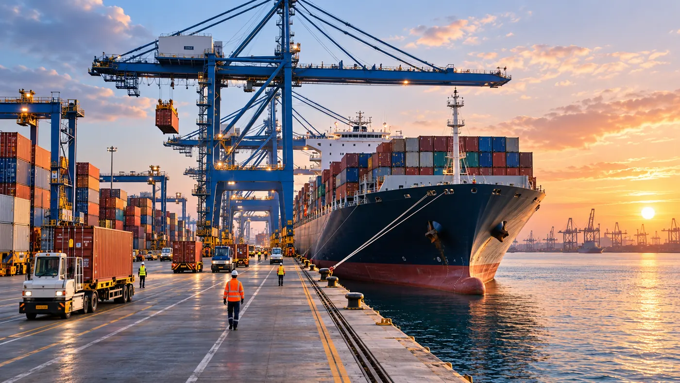 Global maritime geography · illustrative imagery


